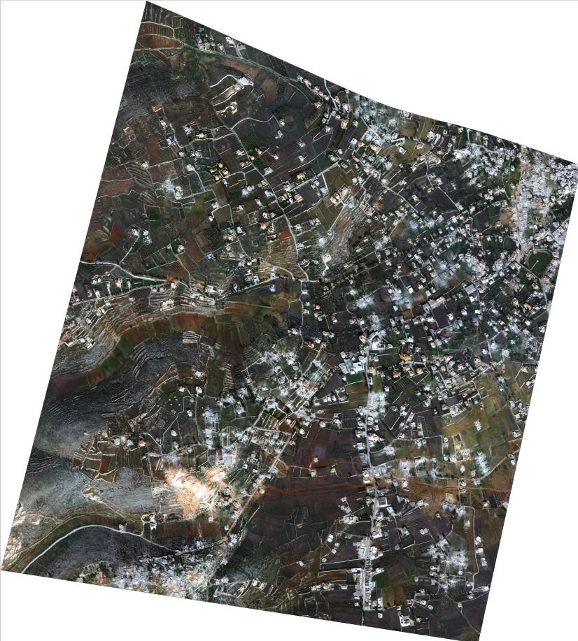
A satellite map showing the locations of destruction and bombings in Mais al-Jabal — the most recent image captured on January 15, 2025.
The areas covered in white dust mark the sites of devastation and collapsed buildings.
At the time, this was the only way villagers could check on their properties, as the area had been entirely cut off from media coverage and on-the-ground journalism due to the Israeli occupation.